Wayanad Ghat Road Guide: Which Entry Route to Choose — and Why It Matters
Wayanad has four entry roads — and each one unlocks a completely different version of the destination. Most travellers follow their GPS to the first result. This guide helps you choose the right one for your trip.
Why Your Entry Route Defines Your Experience
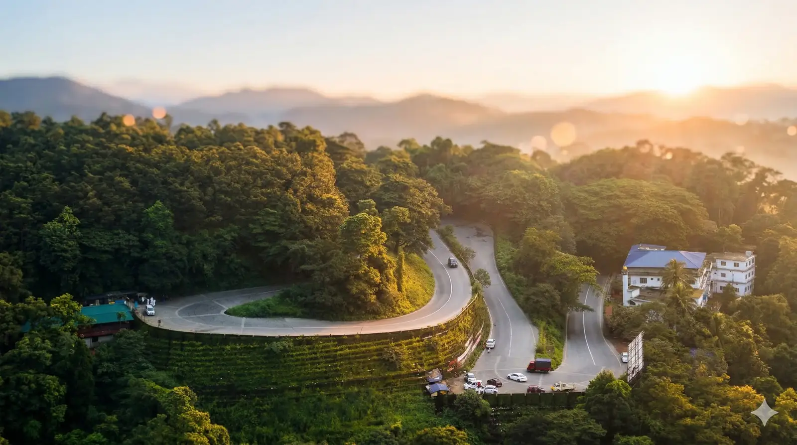
Wayanad occupies the northern highlands of Kerala at 700–2,100 metres above sea level, physically separated from every neighbouring region by Western Ghats ridges. The district spans over 110 km east to west — which means arriving via the wrong entry point can add two unnecessary hours of driving before your holiday even begins. Matching your route to your accommodation zone is the most underrated piece of Wayanad trip planning.
The Four Entry Routes at a Glance
Route | From | Best For | Difficulty |
|---|---|---|---|
Thamarassery Churam | Kozhikode / Calicut Airport | First visits · waterfalls · resorts | Moderate |
Gudalur–Sultan Bathery | Ooty / Mysore / Bangalore | Wildlife · archaeology · coffee estates | Easy-Moderate |
Bavali Forest Route | Kannur | Photography · tribal culture · solitude | Moderate |
Nilambur Teak Forest | Malappuram / Thrissur | Forest lovers · scenic drive | Moderate (permit) |
 Route Profiles
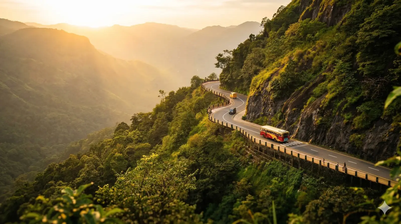
Thamarassery Churam — The Classic Entry from Kozhikode
Nine numbered hairpin bends carry you from the Malabar lowlands up to the misty Lakkidi plateau in roughly 45 minutes. This is the natural route from Calicut Airport and Kozhikode railway station. The views from the upper bends — clouds sitting below you in the valley — are a dramatic introduction to highland Wayanad. Best matched to stays in Vythiri, Lakkidi, and Kalpetta.
💡 Timing: Leave Kozhikode before 6:30 AM on weekends. By 9 AM, tourist traffic backs up the hairpin stretch significantly.
Gudalur–Sultan Bathery — The Eastern Entry from Tamil Nadu/Karnataka
This flatter route through the fringes of Mudumalai and Nagarhole wildlife corridors is the natural approach from Ooty, Mysore, and Bangalore. Elephant crossings are common after dusk on this stretch. Best matched to stays near Sultan Bathery, Ambalavayal, and eastern Wayanad attractions.
Bavali Forest Route — The Offbeat Northern Entry from Kannur
Threading through bamboo groves, tribal settlements, and untouched evergreen forest, the Bavali route into Mananthavady is genuinely off the tourist map. Ideal for photographers and repeat visitors. Recommended vehicle: decent ground clearance, especially post-monsoon.
Nilambur Teak Forest Road — The Scenic Entry from Malappuram
This road passes one of the world's oldest surviving teak plantations — colonial-era trees planted in the 1840s — before climbing into Wayanad. Access requires a forest department permit and has daylight-only restrictions. Confirm current timings before planning this entry.
The Biggest Wayanad Planning Mistake
Booking accommodation in Vythiri and entering via Sultan Bathery — or vice versa — adds nearly two hours of mountain driving on Day 1. Decide your primary activities first, then choose the zone closest to them, then pick the entry route that delivers you there directly. On decoupen.com, properties are tagged by zone to make this matching effortless.
Five Things to Do Before Any Ghat Drive
- Fill fuel in Kozhikode, Gudalur, or Nilambur — stations are sparse once you enter the district.
- Download offline maps — signal drops on all four ghat routes.
- Carry motion sickness tablets for children and first-time ghat passengers.
- Avoid driving after sundown — wildlife is active on all ghat roads at night.
- Check Kerala PWD updates after heavy rain — landslides can temporarily close sections.
- Know your entry. Book the right zone. Find your Wayanad stay at decoupen.com.